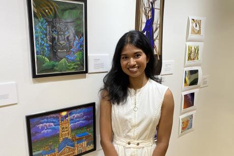
Sydney Neeley MS'16 works at the United Nations headquarters in New York where she attended sessions at the General Assembly in September 2019.
Published October 24, 2019, last updated on November 18, 2020 under Alumni Stories
Sydney Neeley, originally from Portland, Oregon, graduated from Duke in 2016 with a Master of Science degree in Global Health and a certificate in Geospatial Analysis through the Nicholas School of the Environment. Now, she works with the United Nations Development Programme (UNDP) in New York. DGHI’s Brianna Rochelle recently caught up with her to ask how she’s applying her global health education in her career.
What drew you to global health?
I was originally drawn to global health through my undergraduate degree in International Development at the University of Denver. I was interested in epidemiology, and at the same time I was learning about this software called GIS, or geographic information system. The possibilities of applying GIS to global health are still kind of novel. So I saw that at Duke there were courses that you could take in GIS as part of your technical requirement, so I wanted to combine those two areas: technical expertise with global health.
How would you describe your global health passions?
I'm really interested in how health is related to the environment. I focused my thesis on how environmental variables are connected to malaria vector breeding sites in Western Kenya, so my passion was in connecting the dots between the human factors of the disease and how they relate to climate and environmental conditions. This is where geospatial analysis becomes very useful.
Has there been a study or project you were involved with, either during your time at DGHI or afterward, that has been particularly compelling or impactful for you?
Yes! Shortly after I graduated, I went to Guatemala for a year. The malaria unit at the Universidad del Valle de Guatemala was doing a study in collaboration with the Ministry of Health. They hired me as a GIS analyst, so I did a lot of fieldwork in rural Guatemala, mapping cases of malaria and malaria vector breeding sites, as well as mapping the environmental characteristics of these breeding sites to see which were important to the distribution of malaria cases, or "hot spots.”
That project was conducted by a local team from the university, but it was funded and managed by the Clinton Health Access Initiative (CHAI). The project was similar to what I did for my thesis at Duke, but in Guatemala I got to learn more about how international health organizations work and how they interact with local institutions. Things were way less organized than I expected, so I saw how things don't get done very quickly because of miscommunication or cultural differences. So even apart from the actual health science of it, I learned about how international health projects actually operate on the ground.
What would you say was your most memorable experience at Duke? What did you like most about your time here?
Probably everyone says this, but it was definitely the fieldwork that I did because I was able to have authorship over my project and what I wanted to accomplish. Also, being able to work with (DGHI associate professor) Dr. Wendy Prudhomme-O'Meara was a major highlight. Her expertise in all things malaria and connections with the communities in Kenya where I conducted my fieldwork definitely enriched my project results as well as my experience. I felt that my experience in Kenya was not governed by a checklist of work I needed to accomplish, but rather I learned that just simply learning to live in, learn from, and navigate within the culture was just as important to my growth as a master’s student in this field.
In what ways would you say global health program prepared you for the work you’ve done since graduating?
Definitely the research. The research component of the program trained me to think about problems more analytically and comprehensively. Knowing how to form a research question and how to gather the right kind of information to answer that question is really important for my work at UNDP. Whether I am asked to assess the damage of a natural disaster or to develop a multi-dimensional poverty index, I approach my work in a similar way that I developed my master’s thesis: first I brainstorm and gather the necessary information to develop the steps to accomplish the goal at hand. Often it is easier to rush into a project or a situation without having a well thought-out action plan, and I have seen this being less efficient and effective in the end.
Tell us a little more about your current work.
I work with the United Nations Development Programme (UNDP) now, in their Office for Information Management and Technology. I work with all the global UNDP projects related to poverty, climate change and environment, as well as crisis response, and monitoring and evaluation. I provide supporting data and analysis for these projects based on information that is derived from satellite imagery and GIS. I also focus a lot on capacity building efforts by training colleagues in UNDP country offices in how to use GIS and satellite imagery in their work themselves.
One example related to global health is in Colombia that I'm working on now. They need to know the level of infrastructure that is in place (for example, hospitals, clinics, schools and roads) across different municipalities. I'm able to use satellite data and other geo-referenced information to create maps for them, so they know where they can prioritize the need for more development or more health access in these communities. It's really exciting!
Like I said in the beginning, this connection between GIS and development--people are doing it, but it's still pretty new, and it's really exciting to encourage UNDP to use satellite images to support their projects because it can even reduce the need for teams to go out into the field in high-risk or conflict areas. Leveraging satellite data is a safer and more efficient way to carry out many activities in global development because you're able to analyze large areas at a time instead of sending people out to do manual surveys.
What are your plans for the future?
My plans are to continue building my technical skills and perhaps pursue a PhD in the future. I enjoy my work at UNDP, but I do also miss elements of academia – mainly having more time to develop a project and plan of action to accomplish something specific. At the UN, everything has to move so quickly and there are so many different project needs that it becomes a challenge to juggle everything. So far the challenge has been exciting, so I hope to continue learning from my experience working here for awhile longer.